
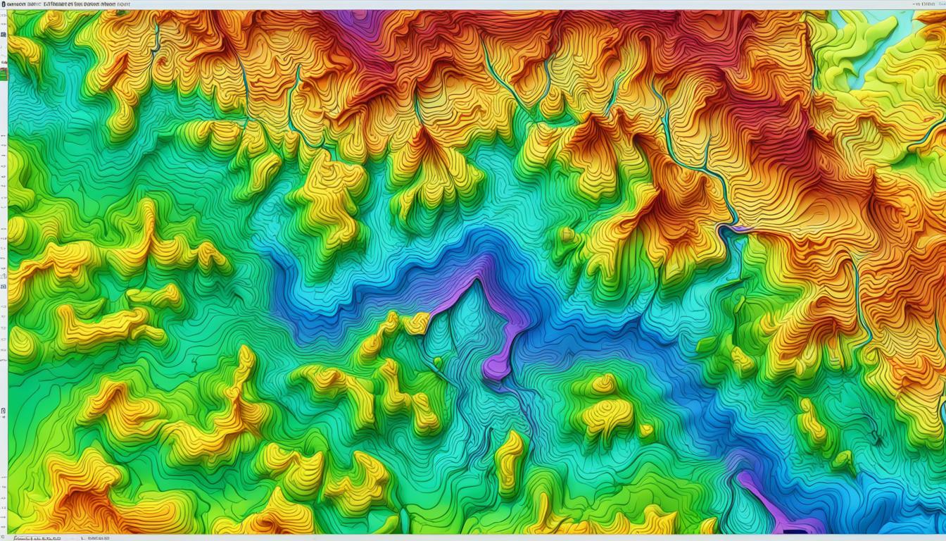
Digital Surface Model
Key Takeaways
- Discover the essence of a digital surface model and its comprehensive portrayal of Earth’s surface.
- Understand the crucial role of DSMs in modern sectors requiring topographical accuracy and detail.
- Explore the contributions of DSM technology to advancements in environmental management and urban development.
- Recognize DSM as a transformative force in the interpretation and application of geographical data.
- Evaluate the implications of DSM in supporting industries that drive the future of our ecological and architectural landscapes.
Introduction to Digital Surface Models
The digital surface model definition encapsulates a paramount aspect of modern topography and cartography, proving essential within the realm of Geographic Information Systems (GIS). As we delve into the utility and transformative potential of DSM in GIS, it becomes evident that this technology is not merely about mapping; it’s about bringing a higher level of precision and realism to our understanding of the physical world.
DSMs capture the Earth’s surface as it is, including all natural and man-made features. This capability makes it a critical resource in various applications, from urban planning to environmental management. The integration of DSM in GIS enables professionals to analyze landscapes and environments with an accuracy previously unattainable, offering a bird’s eye view that is richly detailed and remarkably comprehensive.
The following table outlines key distinctions between a DSM and a basic topographic map, showcasing why DSMs are heralded for their advanced attributes and utility in intricate geographic assessments.
At a glimpse, this comparison clarifies why the in-depth, three-dimensional insights provided by DSMs are indispensable in contexts where precision and depth are critical. By defining and utilizing digital surface models within GIS frameworks, professionals across disciplines are equipped to make more informed decisions, backed by data that is both deep and broad in its depiction of real-world conditions.
| Feature | Basic Topographic Map | Digital Surface Model (DSM) |
|---|---|---|
| Inclusion of 3D Objects | Limited or stylized representations | Accurate, real-world depiction |
What is a Digital Surface Model
Exploring the realm of geospatial technologies, the digital surface model definition occupies a crucial spot, illustrating the topographical layer that includes all objects on the Earth’s surface. Beyond just the natural landscape, DSM captures buildings, vegetation, and infrastructure, portraying a comprehensive view essential for various DSM uses.
The Concept of Digital Elevation Models
Digital Elevation Models (DEMs) provide a bare-earth elevation perspective, crucial for understanding geological and hydrological phenomena. However, when buildings, trees, and other infrastructure are included, the model graduates to what we know as a Digital Surface Model (DSM). This augmentation is pivotal as it enables detailed analyses for urban planning, telecommunication network setups, and environmental studies.
Understanding the Surface in DSM
DSMs uniquely encapsulate the extra layer of surface features that DEMs strip away, offering a blend of natural and man-made structures. This comprehensive representation is invaluable in contexts where interactions between natural landscapes and human modifications are crucial.
For instance, in urban sprawl analysis, DSM provides a multi-dimensional view, allowing city planners to simulate and plan infrastructure more effectively. Similarly, for environmental conservation efforts, being able to assess the height of vegetation and its distribution can offer insights into ecological conditions and patterns.
Understanding the full spectrum of a digital surface model’s utility begins with recognizing its comprehensive nature — a synergy between the earth’s intrinsic contours and human contributions. Here’s an overview of where DSMs are prevalently applied:
- Urban development and planning
- Telecommunications
- Environmental management
- Disaster management and mitigation
The varied DSM uses underscore its importance and expansive capability in professional fields that depend on accurate and detailed topographical data. As we progress further into technology-driven eras, the significance of DSM in these sectors is poised only to grow.
Comparing DSM with Digital Terrain Models (DTM)
The difference between DSM and DTM is pivotal for professionals across various industries who rely on precise topographical data. Understanding how these models vary not only enhances the accuracy of their analyses but also allows for more informed decision-making and strategic planning.
At its core, the difference between DSM and DTM lies in the kind of surface they represent. A Digital Surface Model (DSM) captures both the natural terrain and the built or artificial features on top of the ground. In contrast, a Digital Terrain Model (DTM) represents the bare earth’s contour lines and is devoid of any man-made structures or vegetation.
This distinct difference alters how these models are used in practice. For instance, a DSM is extensively used in planning and simulation processes where surface objects are necessary for accurate representation, such as in telecommunications for line-of-sight network planning or in environmental studies assessing solar potential. Meanwhile, a DTM might be preferred in geological applications where a precise representation of bare earth is required.
| Feature | DSM | DTMs |
|---|---|---|
| Content | Includes buildings, vegetation, and other surface objects | Only includes the bare ground surface without any objects |
| Usage | Urban planning, Risk management in flood modeling | Geological applications, Base for higher-level DSMs |
| Data Source | LIDAR, photogrammetry | LIDAR, radar technologies |
Using difference between DSM and DTM
Using difference between DSM and DTM in practical scenarios is significant. Those engaging with DSM are generally interested in an overall picture, including all surface elements, to create scenarios or visualizations that mimic the real world closely. On the other hand, DTM users often benefit from its precision in showing the raw landform, which is crucial in simulations where surface features are a disruption.
The decision to use DSM or DTM can fundamentally alter the outcome of projects related to environmental assessment, urban planning, or even military logistics. Therefore, choosing the right model based on specific needs and requirements of the project is crucial, underscoring the difference between DSM and DTM.
Both Digital Surface Models and Digital Terrain Models have significant but distinct roles to play in the modern landscape of geographic modeling. Understanding these differences empowers professionals to select the appropriate tool and leverage the correct data for their projects, ensuring optimal outcomes and precision in every undertaking.
Core Benefits of Digital Surface Models
Exploring the multifaceted benefits of Digital Surface Models (DSM) reveals their critical role in modern topography and urban development planning. The utilization of DSM spans a broad spectrum, enhancing both scientific research and practical applications in various industries.
Enhanced Topographic Visualization
DSM plays an indispensable role in creating detailed and accurate representations of the Earth’s surface. By including all above-ground features like trees and buildings, DSM provides a comprehensive picture that is invaluable for environmental studies, disaster management, and geological surveys. Such enhanced visualization capabilities facilitate better decision-making and strategic planning in critical operations.
Importance in Urban Planning and Development
In the realm of urban development, DSM is instrumental in modeling city landscapes and supporting the infrastructural design process. Planners and engineers utilize DSM to assess land use effectively, foresee potential challenges in urban expansions, and optimize the layout of proposed developments for sustainability and efficiency.
Below is an overview of DSM utility in various urban planning scenarios:
| Application | Description |
|---|---|
| City Modeling | DSM enables realistic and scalable 3D city modeling, enhancing visualization and planning accuracy at every development stage. |
| Infrastructure Development | Using DSM data, planners can design infrastructure that integrates seamlessly with the existing landscape, reducing environmental impact and improving project feasibility. |
| Environmental Impact Assessment | DSM provides crucial data for assessing the environmental impact of planned urban projects, helping to maintain ecological balance. |
| Disaster Risk Management | By predicting flood zones and landslide-prone areas, DSM aids in creating more resilient urban spaces. |
As DSM continues to evolve with technological advancements, its applications in enhancing topographic visualization and supporting urban planning functions expand, offering more sophisticated tools and insights for developers and policymakers alike.

Technical Foundations of Creating a DSM
Understanding how to create a DSM involves mastering several cutting-edge technologies and methodologies. Chief among these are photogrammetry, lidar, and radar, each contributing uniquely to the DSM’s overall accuracy and utility. The process not only demands sophisticated equipment but also an in-depth understanding of DSM accuracy requirements.
Photogrammetry utilizes images from aircraft or satellites to create DSMs by measuring the distance between various points on Earth’s surface. Lidar, or Light Detection and Ranging, uses laser light sensors to scan the earth’s surface and reflect back to the sensor, providing precise distance measurements. Radar, or Radio Detection and Ranging, employs radio waves to perform a similar function. Each technology has its unique strengths, making the choice of tool dependant on the specific requirements of the DSM application.
The DSM accuracy requirements are stringent because even small errors can lead to significant misrepresentations of the terrain. The accuracy is influenced by factors such as the resolution of the input data, the technology used, and environmental conditions during data acquisition.
| Technology | Strengths | Common Uses |
|---|---|---|
| Photogrammetry | High-resolution imagery and cost-effectiveness for large areas | Urban planning, forestry |
| Lidar | Precision and ability to penetrate vegetation | Flood modeling, high-precision forestry |
| Radar | Less affected by weather conditions, functional during night | Geological observations, soil and landform mapping |
How to create a DSM is far more than a technical exercise; it is an artistic endeavor that fuses technology and environmental understanding to better comprehend and document our world. The meticulous adherence to DSM accuracybe requirements ultimately governs the quality of all subsequent applications, ensuring that stakeholders can make decisions based on reliable, precise models.
DSM Uses in Various Industries
The integration of Digital Surface Models (DSMs) across diverse sectors highlights their versatility and critical role in enhancing industry-specific operations. DSM applications have proven pivotal in revolutionizing how sectors such as agriculture, telecommunications, and environmental studies approach their daily challenges and long-term planning strategies.
Application in Agriculture
In the agricultural sector, DSM applications assist in precision farming techniques, enabling farmers to better understand the topology of their lands. This includes identifying variations in field elevation that affect irrigation and drainage, optimizing input usage, and ultimately maximizing the yield. DSM data helps in analyzing soil properties and terrain slopes which are crucial for planting strategies.
Role in Telecommunications
The telecommunications industry benefits from DSM applications by using these models to plan the location of cell towers for optimized signal distribution. The detailed surface information provided by DSMs helps in understanding the landscape features that might obstruct telecommunications signals, thus aiding in designing more efficient networking routes.
Value for Environmental Studies
Environmentalists utilize DSM for various applications including flood modeling and forest management. By analyzing the elevation data, DSMs enable the prediction of water flow paths and accumulation zones, which are critical in planning flood defenses. Additionally, DSM applications help in tracking changes in vegetation cover, aiding efforts in deforestation analysis and ecological conservation.
| Industry | DSM Application | Benefits |
|---|---|---|
| Agriculture | Precision farming, soil analysis | Increased crop yield, optimized resource use |
| Telecommunications | Network planning, tower placement | Enhanced signal distribution, reduced costs |
| Environmental Studies | Flood modeling, vegetation monitoring | Improved disaster preparedness, ecological preservation |
The Accuracy Requirements for DSM
The precision of a Digital Surface Model (DSM) is crucial for a wide range of applications—from urban planning to environmental monitoring. Achieving high DSM accuracy requirements is not only essential for foundational data collection but also for sophisticated analytical processes where minor discrepancies can have significant impacts.
Factors Affecting DSM Precision
Several factors influence the accuracy of DSMs. Environmental conditions, sensor quality, and data processing techniques play pivotal roles. For instance, atmospheric conditions can affect the quality of the imagery used to create DSMs, while the caliber of the sensors determines how finely the surface details are captured.
Accuracy Standards across Different Applications
Depending on the intended use of the DSM, accuracy requirements may vary significantly. For high-stakes applications like flood risk management, stringent standards are mandatory to ensure reliability and safety.
| Application | Required Accuracy | Typical Use |
|---|---|---|
| Urban Planning | ±5 cm | City modeling, infrastructure design |
| Forestry | ±10 cm | Canopy analysis, biomass estimation |
| Telecommunications | ±15 cm | Signal propagation modeling |
| Environmental Monitoring | ±2 cm | Erosion assessment, habitat analysis |
DSM in GIS: Methodologies and Tools
The integration of Digital Surface Models (DSM) in Geographic Information Systems (GIS) has transformed the realm of spatial analysis and modeling. This advancement underscores the significant role of DSM applications in augmenting GIS functionalities, making it a pivotal asset in various disciplines and industries.

DSM in GIS encapsulates a comprehensive approach to data handling and interpretation, enabling professionals to achieve more detailed and accurate outcomes in their spatial projects. The methodologies involved in incorporating DSM into GIS platforms are both intricate and innovative, paving the way for advanced mapping and analysis capabilities.
- Creation of enriched topographic maps that offer greater detail and usability for planning and development projects.
- Analysis of geographical distributions for environmental studies, urban planning, and resource management.
- Enhanced 3D visualizations that provide stakeholders with realistic and interactive representations of their projects.
Furthermore, the tools utilized in DSM applications within GIS systems are crucial for extracting maximum value from the models. These tools facilitate the integration of vast datasets, allowing for more sophisticated analyses and interpretations. From simple elevation queries to complex visibility assessments, the use of DSM in GIS continues to evolve, presenting new opportunities for comprehensive environmental and urban studies.
The synergy between DSM and GIS technologies fosters a unique environment where spatial decision-making is greatly enhanced, leading to smarter, more sustainable outcomes.
In conclusion, the combination of DSM methodologies and tools within GIS platforms illustrates a dynamic progression in how spatial data is analyzed and utilized. It represents not only a technical enhancement but also a broader shift towards more informed and efficient geographic analysis interventions.
Step-by-Step Guide on How to Create a DSM
Embarking on the journey of creating a Digital Surface Model (DSM) is both an exciting and technical undertaking that can significantly enhance your understanding of geographical landscapes. Below, we provide you with a comprehensive outline of the pivotal processes involved in creating a DSM, which serves as an essential tool for various analytical purposes.
Data Collection Methods
Initial data collection is crucial when you are learning how to create a DSM. Principally, it involves gathering raw spatial data through methods like LiDAR (Light Detection and Ranging), photogrammetry, or satellite imagery. Each method offers distinct advantages depending on the project’s needs, whether it’s the high accuracy of laser LiDAR or the broad coverage of satellite images.
Processing Techniques for DSM Generation
Once data collection is complete, the focus shifts to processing this data to construct a usable model. The steps generally include data cleaning, alignment, and interpolation to create a continuous surface. Advanced software tools are employed to handle this intricate process, ensuring the DSM’s accuracy and reliability.
In the spirit of visual learning, let’s take a look at a detailed table that compares various processing techniques utilized in DSM generation, underscoring their effectiveness and specific applications:
| Technique | Application | Advantages |
|---|---|---|
| Lidar Processing | Forestry and urban modeling | High-resolution data acquisition |
| Photogrammetry | Environmental studies, archaeology | Cost-effective and accessible |
| Satellite Imagery | Large-scale landscape analysis | Extensive area coverage |
By integrating these methods appropriately, one can adeptly navigate the complexities of creating accurate and highly detailed digital surface models. This capability is not only a technical achievement but also a powerful tool in the realm of spatial analysis and environmental management.
Future Prospects of DSM Technology
As the demand for precise geographic data surges, the future horizon for DSM technology looks particularly promising. Innovations in remote sensing and the integration of new technologies like AI and IoT are set to significantly refine and expand the capabilities of digital surface models.
Advancements in Remote Sensing
The evolution of remote sensing technology plays a pivotal role in the development of DSM technology. With enhanced satellite imagery, drones, and airborne sensors, the precision and accuracy of digital surface models are improving, enabling more detailed and comprehensive environmental and geographical analysis. These technological strides will undoubtedly amplify the DSM future prospects, making DSMs indispensable in fields ranging from urban planning to environmental conservation.
Integration with Emerging Technologies
The confluence of DSM technology with emerging technologies such as artificial intelligence (AI) and the Internet of Things (IoT) sparks a transformative potential in data analysis and application. AI algorithms can automate the processing of vast amounts of DSM data, significantly speeding up the analysis while ensuring precision. Similarly, IoT devices can provide real-time data that feed into DSMs, offering updated information that can lead to more dynamic and responsive models.
As we look to the future, these integrations are expected to not only enhance the granularity and utility of DSMs but also pioneer new applications and methodologies that could revolutionize how we understand and interact with our physical environment. Clearly, the DSM future prospects are aligned with broader trends in tech innovation, poised to unlock unprecedented opportunities in numerous sectors.
Real-world Examples and Case Studies of DSM Applications
Exploring DSM case studies and DSM real-world examples not only illustrates the versatility of Digital Surface Models but also highlights their profound impact across different sectors. By analyzing tangible implementations of DSM technology, we can gain insights into its effectiveness and adaptability in real-world scenarios.
Agricultural Management: In the agricultural sector, DSM technology has revolutionized land management and crop monitoring. One particularly striking case involves using DSM to optimize water resource management in large-scale farming operations. The ability to analyze surface variations helps in effective irrigation planning and terrain analysis, leading to better crop yields and resource management.
Urban Planning: DSMs are pivotal in urban development projects where precise topographical data is necessary. City planners leverage these models to plan infrastructure projects, considering land elevation and terrain obstacles effectively. This aids significantly in reducing costs and improving the efficiency of developmental
Environmental Studies: Environmental scientists utilize DSMs to study natural habitats and assess the impact of human activities on various landscapes. Through DSM technology, changes in terrain and landscape over time can be meticulously monitored, providing crucial data for ecological conservation efforts.
These DSM case studies exemplify the real-world applicability and benefits of Digital Surface Models, highlighting their capacity to provide detailed and actionable insights in diverse fields.
Conclusion
As we reach the end of our exploration, it is clear that the realm of digital surface models is both extensive and vital. Our journey through the digital surface model overview has displayed the dynamic nature of DSMs as an indispensable tool across various professional sectors. The importance of this technology has only grown as industries ranging from urban development to environmental management rely on the intricate detail and accuracy that DSMs provide.
In the evolution of geographic interpretation and land analysis, the role of DSMs has been transformative. From precise elevation data to enhancing topographical visualization, DSM technology enables professionals to execute tasks with an unprecedented level of insight and precision. The integration of DSM into GIS and other advanced systems is not just a step towards more substantial data analysis; it represents a leap towards a future where our understanding of the Earth’s surface knows no bounds.
As we synthesize the information presented, the digital surface model overview we’ve developed is a testament to the power of DSM in shaping our world. Aspiring to leverage the full potential of these models invites us all to engage with a technology that offers a clearer vision of our planet. The drive to further explore and adopt DSM technology signals a commitment to progress and a doorway to unlimited possibilities for innovation in the landscapes of tomorrow.